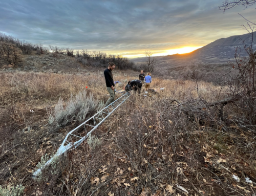

Members of Yampa Valley Sustainability Council and Colorado Mountain College joined a team from Airborne Snow Observatories to collect snow data on Rabbit Ears pass April 11. The data will add to the picture scientists have of how much snow melt will turn to water in local rivers and streams.
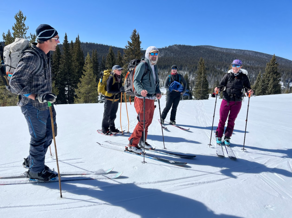
Seeing planes fly low across the sky or driving past a group of backcountry skiers ready to hike on Rabbit Ears Pass isn’t a rare sight in the Yampa Valley.
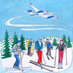
Art by Jill Bergman
But on the morning of April 11, 2024, a group of scientists strapped on their skis not in pursuit of great powder turns, but to learn more about the snowpack that makes the Yampa Valley home to its world class recreation and so much more.
The group, comprised of members of Colorado Mountain College (CMC), staff from Yampa Valley Sustainability Council (YVSC) and led by Airborne Snow Observatories, Inc. (ASO), was on a mission to collect samples that would verify flyover data on the Yampa Basin’s snowpack simultaneously being collected by a King Air B200 aircraft.
“It’s happening on such a time scale that it’s almost unfathomable by the human brain, and at an accuracy that is just outrageous.”
– Jeff Deems, ASO Co-founder
This data will help local water managers predict how much water will enter the rivers during the spring runoff season, influencing decisions in the realms of agriculture, river recreation and wildlife management.
“Having lived in Steamboat for a number of years (in the past), I have a personal feeling as a backcountry skier for what the snowpack is like typically in the Yampa Valley, so I’m really excited to actually see this,” said Jeff Deems, co-founder of ASO. “Today will be the first quantitative map of snow depth and snow water equivalent for the Yampa Valley that we’ve ever seen.”
Airborne Snow Observatories (ASO) is a public benefit corporation that uses world-class technology to take highly accurate measurements of snow water equivalent and snowmelt runoff forecasts, which allow resource managers to predict how much snow melt will end up in the river each given year.
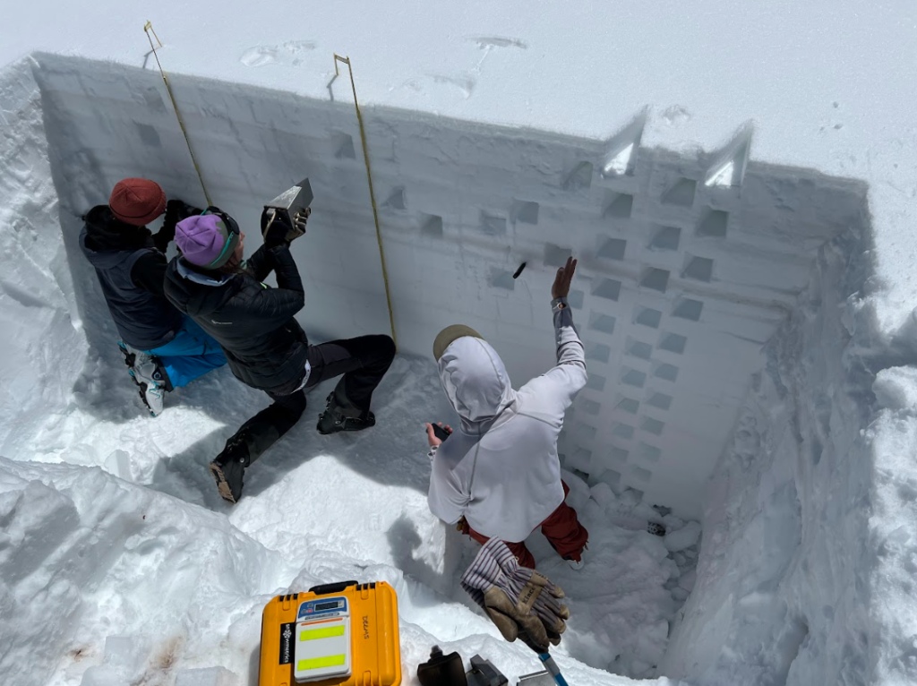
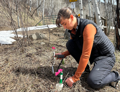
Airborne Snow Observatories Co-founder Jeff Deems, right, gives pointers to YVSC staff Madison Muxworthy and Abby Vander Graaff, left, while they take snow density measurements on Rabbit Ears Pass April 11, 2023.
In the Yampa River Basin, the group did this by taking measurements with light detection and ranging (lidar) technology attached to an airplane that flew around the entire watershed.
“The lidar sensor scans back and forth under the aircraft, shooting out something like a couple hundred thousand laser pulses per second as its flying along,” Deems said. “Each one of those pulses is giving us an elevation measurement … that we then convert to snow depth by comparing (it) to the elevation map we made in the summer.”
The plane measures the snow depth every 10 feet across the entire watershed, which the scientists can then use to find snow water equivalent, or the amount of water that would be present if the snowpack melted, using a computer model.
“(The scans are) happening on such a time scale that it’s almost unfathomable by the human brain, and at an accuracy that is just outrageous,” Deems said. “Our snow depths are accurate to the order of a couple centimeters, and we have this really reliable snow depth map, everywhere, including under the forest, basin-wide, that forms the foundation for us to get an accurate snow water volume throughout the basin.”
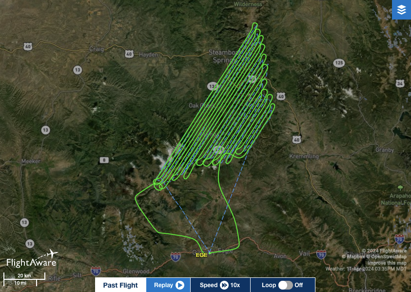
A map shows the zig-zagging flight path of the aircraft used by Airborne Snow Observatories to take snow data measurements. (Courtesy of Airborne Snow Observatories Inc.)
At the same time the plane was in the sky, the on-the-ground ASO group took measurements of snow temperature and density, which helped verify the plane’s flyover data and provide extra data points to plug into the computer model.
They did this by digging a pit from the surface of the snow all the way to the ground, then taking various measurements at different levels in the snow.
In addition to snow density, the flyover data also provides insights on the reflectiveness of the snow — albedo — which helps scientists determine how quickly it may melt.
A crystal ball for water supply?
In the mountain West, much of the water supply is stored in the snowpack, in addition to in rivers and reservoirs. In the Yampa River Basin, snowpack is responsible for storing about 70% of this water supply.
“Our rivers and reservoirs are fed by springtime snowmelt, which is becoming increasingly difficult to accurately forecast amidst drying and warming in the West,” said Nathan Stewart, an ecosystem science professor at CMC. “Meltwater now runs a gauntlet of thirstier soils and trees and warmer and drier air as it makes its way from our mountains to our valley floors.”
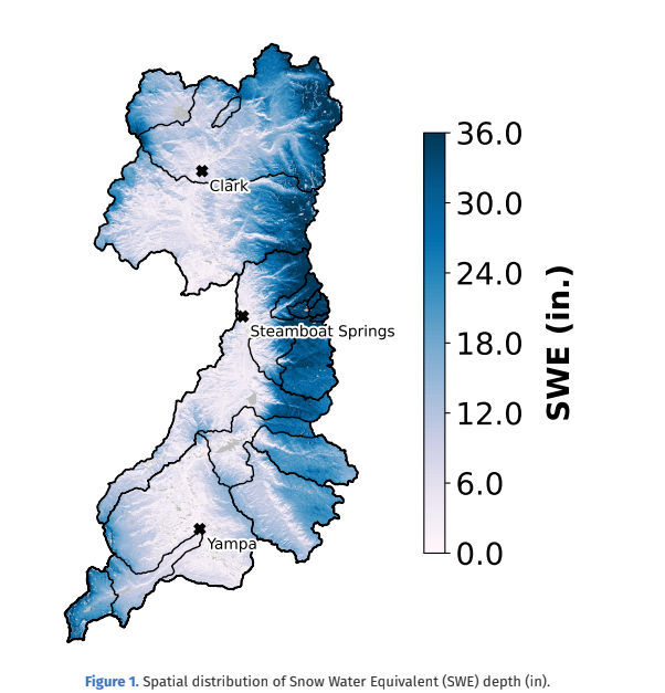
A graph produced by Airborne Snow Observatories, Inc. (ASO) shows the spatial distribution of snow water equivalent depth in inches across the Yampa Basin. (courtesy of ASO)
The data will add another piece to the picture of information local scientists already have on the valley’s snowmelt thanks to meticulous data being kept by the Yampa Basin Atmosphere and Soil Moisture Integrated Network (YBASIN) stations and Natural Resources Conservation Service’s Snow Telemetry (SNOTEL) stations, which track snow and atmospheric data at a specific location — a resource known as point data.
“Things can change if you step just a foot away, the aspect changes and all these different variables come into play,” said Madison Muxworthy, the soil moisture, water and snow program manager at YVSC. “The (ASO data) complements those point data really well, and it gives us more data that we can use to inform our water resources planning and better understand the current and projected changes that we’re seeing.”
At the same time, the ASO scientists are using local YBASIN and SNOTEL data to verify their own measurements and models.
Muxworthy explained that the community is already seeing the impacts of climate change in the Yampa River Basin, which makes understanding local water resources ever more critical.
“The Yampa Valley has a really rich agricultural industry here, so the more information we can give them, the more prepared they can be for these changes that they’re already experiencing,” she said.
In addition to the sharing of data, the collaboration between organizations allowed local scientists and students to learn more about this special technology and how it can have an impact on future climate work.
“Our collaboration with ASO helps springboard partnerships and projects already underway in the Yampa Valley, including the ongoing development of YBASIN, a network of weather stations monitoring soil and atmospheric conditions throughout the basin and supplementing the existing networks in the region, such as the NRCS’ foundational SNOTEL sites,” Stewart said.
Efforts to learn more about local snowpack, especially when used in collaboration, can have a meaningful impact on daily life in the Yampa Valley.
“Whether you’re interested in … flows through town for fishing or tubing or kayaking, especially later in the summer, or whether you’re an agriculture producer in the Yampa Valley with water rights, especially junior water rights that are likely to be curtailed if we’re short on water, then you’re interested in better knowledge and better management of that water resource,” Deems said.
To view the ASO data, click here.
April 23, 2024 | Abby Vander Graaff, Communications & Administrative Coordinator