YBASIN: Yampa Basin Atmosphere and Soil Moisture Integrated Network
Soil moisture data can provide key insights into how we predict and make decisions about water resources in the Yampa River Basin.
Why Soil Moisture and Climate Monitoring?
Soil moisture plays an important role in influencing water supply, especially in snowmelt-dominated headwater areas – like the Yampa River Basin – which relies heavily on snowmelt to deliver our water supply as we lack large reservoirs to store water. We are already seeing examples of how critical soil moisture is when it comes to our water supply. In the water year 2021, our basin snowpack was average at 89% of the median but only produced 30% of normal streamflows. It is hypothesized that a large part of that loss is due to dry soils.
You might be wondering why soil moisture is so influential for water resources. The process is complex, but a good analogy is that our soils act as a sponge. When they are dry, they absorb snowmelt before any water can make it to our rivers and streams. This relationship between snowpack, soil moisture, and streamflows is further complicated when we experience below-average snowpack, aridification, and record-breaking temperatures – all leading to a less predictable water supply. By establishing a network that collects these missing data – along with a suite of other hydrometeorological data – we can better prepare for a changing water supply.
What we’re doing:
In 2021, Yampa Valley Sustainability Council, Center for Western Weather and Water Extremes, and Colorado Mountain College partnered to plan and establish the Yampa Basin Atmosphere and Soil Moisture Integrated Network (YBASIN) in the Yampa River Basin with initial funding from the Upper Yampa Water Conservancy District.
The project aims to establish new long-term soil moisture measurements to provide data and scientific insight on the reduction of runoff by dry soils, provide a continuous record of changing landscape conditions with a changing climate, and support model and forecast improvements. The monitoring network seeks to provide data for stakeholders to better understand and make management decisions about our changing water supplies.
In 2021, we started to conduct a robust analysis of the Yampa River Basin to assess climate influences on soil moisture variability to help identify where these stations would be most impactful and enhance existing climate-related stations in the basin. As part of this process, we conducted stakeholder meetings to better understand data needs and current observational gaps. We assessed the atmospheric drivers of soil moisture variability and their changes over time, along with landscape characteristics key to modulating water movement throughout the basin. We then incorporated this information with existing station locations and stakeholder input to identify where to place the stations for the network.
The first station was installed on private property in the Stagecoach area in September 2022. In 2023, the project team received funding from the Colorado Water Conservation Board’s Water Plan Grant, Colorado River District’s Community Funding Partnership and Upper Yampa Water Conservancy District to expand this project through 2026. Learn more about our network and other stations below.
View the live data from the network on the Center for Western Weather and Water Extremes’ website here.
For more information about this project, contact Madison Muxworthy, madison@yvsc.org, (970)871-9299 ext. 107.

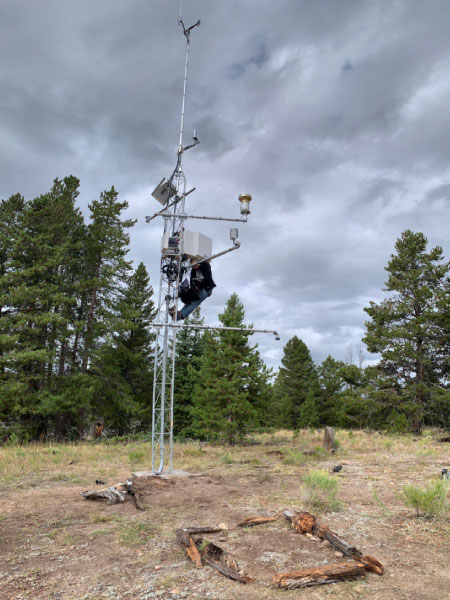
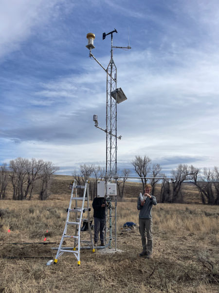
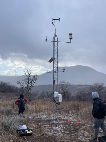
Anemometer
This sensor measures horizontal wind speed and direction at the site

Communications
The cellular gateway allows the data collected at the station to be transmitted in near real-time through a cellular network

Solar Panel
This solar panel provides electrical power for the station to run

Pyranometer
This sensor is measuring the incoming solar radiation
Rain Gauge
This sensor is measuring liquid precipitation (i.e. rainfall)

Barometer and Datalogger
The barometer is measuring atmospheric pressure and datalogger houses the programming for the station and sensors, converts the data and stores it
Temperature and Relative Humidity
This sensor is measuring the air temperature and relative humidity

Snow Depth
The snow depth sensor is measuring the height or depth of the snowpack
Fuel Temperature and Humidity
These sensors are measuring a proxy for the surrounding fuel temperature and moisture of woody materials
Soil Moisture and Temperature
These six sensors are buried in the ground and measure the profile of soil’s moisture content and temperature at 5, 10, 15, 20, 50, 100cm depths


